WHY USE DRONES IN CONSTRUCTION PROGRESS MONITORING & ENGINEERING SOLUTIONS
Construction companies and developers can use drone construction progress monitoring for the following uses
Tracking development and progress regularly by flying drones in the same pattern at regular intervals.
Here’s what DRIFT UAV has been delivering to the construction Industry.
- Creating 360° views of the job site.
- Providing comprehensive safety inspections and quality assurance to make sure that the area is safe and compliant with state and local building models.
- Turning data into 3D models to provide investors with a realistic look at the project.
- Creating CAD overlays to ensure the project is aligning with design plans.
- Determining progress rates and ensuring the project is moving according to schedule.
- Keeping track of job site inventory, Including equipment and materials.
- Identifying areas where structural integrity may be a concern or discovering problems before they become expensive and difficult to fix and repair.
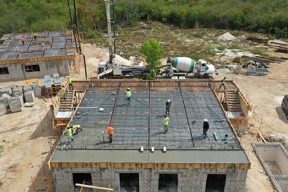
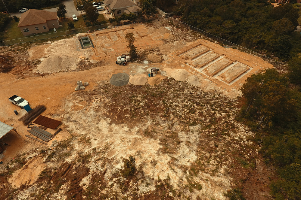
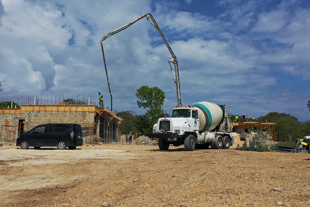
Drones are the tool of choice to efficiently map and inspect all locations. Documentation is fast and more efficient than conventional inspection methods, outputs provide a historic database, all while minimizing exposure to safety hazards.
Our team can track, map, and measure a project’s evolution or provide a one-time survey of your site. You can view your site in a 3D model which is so realistic it feels like you’re on a virtual walkthrough. We can streamline your workflow by calculating cut/ fill volumes, perform grade checks, inspect infrastructure, and incorporate design overlays.

Pre-Planning
Before a shovel hits the ground, a site analysis is always required to assure the location is optimal for the proposed project. Visual data from drones is greatly beneficial in achieving an understanding of the land’s overall layout, elevation, drainage spots, vegetation, and more. These images can be used to easily convey messages across to employees or clients.
Progress Monitoring
Progress updates provided through aerial drone imagery is a beneficial tool for staying on schedule and in turn keep the project from going over budget. Drone imagery can be shared with project managers as well as stakeholders and investors who’re interested in keeping tabs on the project as well. New updated images can be taken monthly, weekly, or daily depending on the speed of building.

Mapping
Drones can use the visual data they collect to produce multiple types of maps including 3D, orthomosaic, and thermal. Each of these aerial maps have many benefits from pre-planning, monitoring progress, understanding a site’s layout, and more. The level of data and precision drone maps can provide are remarkable compared with widely used satellite imagery.

Inspections
During construction, periodic inspections are mandatory to assure overall project status, safety, and accuracy. Some inspections can be hazardous to workers or become inefficient, resulting in lost time and money. Using drones for these jobs will greatly improve speed and assurance between workers. With the ability to take pictures and video, multiple employees will be able to view the status and easily converse about possible issues.

Stockpile Measurements
Using drones for stockpile measurements can significantly save time, improve safety, and cut costs. Measurements such as volume, density, and tonnage can be precisely calculated using drone mapping software. This information can be used for up-to-date inventory counts and to keep worksites stocked with enough materials. Assessing stockpiles more frequently can reduce overestimated material and supply orders, cutting back on waste and unnecessary spending.

Material Reporting & Logistics
Track incoming building materials and verify deliveries using drone footage. Daily reports of received inventory ensure workers have access to the materials they need while reducing waste. Lock in solid logistics for deliveries by using drone software to plan delivery routes and observe the condition of drop-off points, preventing incomplete deliveries due to poor site planning. In construction, drones can be used to acquire additional data for feasibility studies, rapid contour production for infrastructure BOQ preparation, conduct periodic documentation of construction progress, and perform visual inspections of buildings. Drones can also provide a 3D remodeling method in an easy and fast way, to represent the real situation of the construction site. In addition, the resulting output data can also be used for purposes such as review of road plan alignment, topographic analysis, land acquisition calculations, and design validation
Using aerial photography, investors get a comprehensive view of the job site, from planning to completion. In addition to improved communication, consider these additional benefits of using drones for construction project monitoring:


SAVE TIME
Schedule a drone instead of a helicopter, crane, or other methods of getting aerial surveillance and images; you can get the information you need in a fraction of the time.
GATHER INFORMATION AND DATA AT REGULAR INTERVALS
With more frequent progress scans, you can more accurately determine your timeline and find project areas behind schedule. You will also have more opportunities to share up-to-date details with investors and developers, keeping them better informed and building confidence in the project.
IDENTIFY HAZARDS AND IMPROVE SAFETY
Improve safety on your job site by capturing unsafe locations or areas of the build that may not comply with building regulations before an official inspection, saving you time, money, and most importantly, prevent a job site injury.
REDUCE OPERATIONAL COST
Using drones are affordable and allows you to see where productivity may be lagging, ways you can avoid safety problems, and spot red flags before they become serious issues. Keep your construction project within budget and on time.
WHY CHOOSE DRIFT FOR CONSTRUCTION ENGINEERING SOLUTIONS?
As a land developer or architectural engineering firm, you can use drone technology to decrease project times, reduce overall costs, and provide timely, detailed information. Accurate survey-grade results that equal or exceed traditional methods. Regular drone mapping updates keep projects on track and allow all stakeholders to collaborate in a 3D environment during all development phases.
DRIFT UAV services can assist you with the 3D rendering of the site, and the subsequent creation of a layer for each stage of the building, showing the project progression.